 |
Corowa Branch

Summary
| Track: | 76.03 km |
| Stations: | 1 / 10 in use |
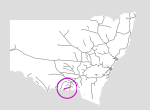
This branch lies in the far south of the state. It branches off the Main South Line at Culcairn, and head south-west to the border town of Corowa. The line was opened in 1892 to transport wheat, and was closed almost 100 years later.
The yard and station at Corowa has been turned into a park and tourist information centre.
| Name | Facility | Status | Opened | Closed | km | Links | ||
|
|
Culcairn | Station | In Use | 1-Sep-1880 | - | 596.820 | 29 | |
|
|
Weeamera | Platform | Closed | Jan-1914 | Jun-1947 | 604.170 | 1 | |
|
|
Hurricane Hill | Station | Closed | 2-Jul-1926 | 19-Feb-1954 | 605.918 | 3 | |
|
|
Walla Walla | Station | Closed | 3-Oct-1892 | 4-May-1975 | 613.590 | 11 | |
|
|
Burrumbuttock | Station | Closed | 3-Oct-1892 | 4-May-1975 | 625.610 | 27 | |
|
|
Orelda | Platform | Closed | 30-Sep-1893 | unknown | 630.050 | 7 | |
|
|
Brocklesby | Station | Closed | 3-Oct-1892 | 4-May-1975 | 636.100 | 20 | |
|
|
Balldale | Station | Closed | 3-Oct-1892 | 4-May-1975 | 651.590 | 16 | |
|
|
Hopefield | Station | Closed | 3-Oct-1892 | 4-May-1975 | 660.730 | 9 | |
|
|
Corowa | Station | Re-used | 3-Oct-1892 | unknown | 672.850 | 8 | 1 |

Summary
| Track: | 76.03 km |
| Stations: | 1 / 10 in use |
| Section | Opened | Closed | Usage | ||
| Culcairn - Brocklesby | 3-Oct-1892 | Dec-1991 | 1 | general | |
| Brocklesby - Corowa | 3-Oct-1892 | 9-Jan-1989 | 2 | general |
2 Last train ran 24-Jan-1988