 |
Tumut Branch

Summary
| Track: | 103.78 km |
| Stations: | 0 / 16 in use |
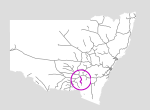
The Tumut branch in the state's south runs from Cootamundra to the mountain town of Tumut. From Cootamundra to Gundagai, it follows the Muttama Creek valley down to the Murrumbidgee. Part of the line between Coolac and Gundagai has been obscured by the Hume Highway. From Gundagai, the line crosses the river and heads up the Adelong and Califat creeks to Gilmore and then to the terminus at Tumut.
The line was abandoned when sections near Cootamundra were damaged by floods in 1984.
In 1988 the Mountain High Railway began using the section near Tumut for tourist purposes, but the group folded less than two years later.
There has been some talk of the line being re-opened, however significant sections have been destroyed by the Hume Highway upgrading, and the link bridge over the Murrumbidgee at Gundagai is probably no longer usable.
| Name | Facility | Status | Opened | Closed | km | Links | ||
|
|
Jct (Tumut Branch) | Junction | Closed | 1-Jun-1886 | 19-Jan-1984 | 430.320 | 2 | |
|
|
Three Mile Tank | Tank | Closed | 1-Jun-1886 | unknown | 434.522 | 3 | |
|
|
Brawlin | Platform | Closed | 1-Jun-1886 | 4-May-1975 | 440.850 | 5 | |
|
|
Muttama | Station | Closed | 1-Jun-1886 | 4-May-1975 | 450.880 | 4 | |
|
|
Bongalong | Platform | Closed | 1887 | 4-May-1975 | 450.000 | 5 | |
|
|
Wambidgee | Station | Closed | 10-Oct-1892 | 4-May-1975 | 458.595 | 2 | |
|
|
Coolac | Station | Closed | 1-Jun-1886 | unknown | 466.850 | 10 | |
|
|
Pettitts | Platform | Closed | 8-Apr-1946 | 4-May-1975 | 469.975 | 2 | |
|
|
Mingay | Unknown | Closed | 4-Dec-1890 | 6-Jul-1971 | 472.218 | 4 | |
|
|
Balls Platform | Platform | Closed | 1-Mar-1893 | Apr-1946 | 475.963 | ||
|
|
Gundagai | Station | Closed | 1-Jun-1886 | unknown | 483.880 | 30 | |
|
|
South Gundagai | Station | Closed | 12-Jan-1903 | 20-Jan-1975 | 485.648 | 4 | |
|
|
Willie Ploma | Station | Closed | 12-Oct-1903 | 5-May-1975 | 492.522 | 2 | |
|
|
Tumblong | Station | Closed | 12-Oct-1903 | 4-May-1975 | 498.550 | 1 | |
|
|
Luadra | Unknown | Closed | Nov-1954 | 4-May-1975 | 502.870 | 3 | |
|
|
Mount Horeb | Station | Closed | 12-Oct-1903 | unknown | 507.390 | 12 | |
|
|
Watertank | Tank | Closed | 2-Dec-1903 | unknown | 510.379 | 1 | |
|
|
Califat | Platform | Closed | 2-Dec-1903 | 4-May-1975 | 513.453 | 2 | |
|
|
Reka | Unknown | Closed | 3-Nov-1906 | 6-Jul-1971 | 519.474 | 3 | |
|
|
Gadara | Station | Closed | 2-Dec-1903 | 4-May-1975 | 522.793 | 3 | |
|
|
Jct (Gilmore) | Junction | Closed | 17-Dec-1923 | 13-Jan-1984 | 528.866 | 1 | |
|
|
Gilmore | Station | Closed | 2-Dec-1903 | 4-May-1975 | 529.010 | 14 | |
|
|
Tumut | Station | Closed | 2-Dec-1903 | unknown | 534.100 | 26 |

Summary
| Track: | 103.78 km |
| Stations: | 0 / 16 in use |
| Section | Opened | Closed | Usage | ||
| Jct (Tumut Branch) - Gundagai | 1-Jun-1886 | 19-Jan-1984 | 12 | general | |
| Gundagai - Mount Horeb | 12-Oct-1903 | 19-Jan-1984 | 12 | general | |
| Mount Horeb - Gilmore | 2-Dec-1903 | 19-Jan-1984 | 12 | general | |
| Gilmore - Tumut | 2-Dec-1903 | 19-Jan-1984 | 1 | general | |
| Gilmore - Tumut | Dec-1988 | 3 | May-1990 | tourism |
2 Date line damaged by floodwaters
3 Re-opened by Mountain High Railway for tourist trains